
NHC: Elsa expected to move across Cuba on Monday; Storm Surge Watch issued for portion of Florida’s coast

Updated: 5:00 PM EDT Jul 4, 2021
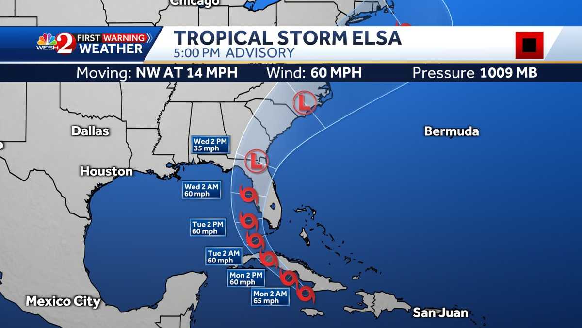
Hello everyone. Uh First morning meteorologist Kellyanne class here we are talking all about her or a topical storm Elsa today the 11 a.m. Advisory was just released. So uh we’re gonna talk a lot about um Elsa today. Uh new information coming on in right now. It’s still a tropical storm uh with winds of 60 MPH moving to the west northwest at 13 MPH, pressure went up a couple of millibars to about 1000 and nine. So it’s weakening very slightly. It’s interacting with Hispaniola right now uh and it’s interacting with Jamaica and cuba. So we are going to be watching this system very closely as we go over the next couple of days as it gets closer and closer to florida. So this is a look right now at tropical storm Elsa. Uh It has a good decent amount of conviction um as it tries to go into the caribbean uh and it’s trying to find the best path right now. It’s trying to move over Jamaica and it’s interacting with the land obviously does not like that as tropical system and it’s beginning to bubble up. So uh This is something that is slowly beginning to weaken but notice those water temperatures 86-85°.. Um So very warm waters that it’s going into. So let’s talk about where we’re at right now. The only watches and warnings in effect hurricane watches and warnings is for cuba. But there are now her tropical storm watches and warnings in effect for not just Jamaica cuba, but now also southwest florida. There’s a tropical storm watch and then there’s a tropical storm warning for portions of the keys. Nothing yet here for central florida or the west coast, but with the latest track from the National hurricane center, it is expected to kind of paralleled, so go over The Key is kind of parallel the western coast and then eventually move towards the Big Bend area of florida. So here is the latest track from the National Hurricane center And it’s saying right around Monday morning it’s going to make landfall in Cuba. Then by the next 12 hours it’s going to emerge off the coast of Cuba With winds of 60 mph notice before makes landfall in Cuba. It has winds of 70 mph as we look towards Monday evening and weakened slightly again. But then it re emerges into the warmer waters of the Gulf. Why is it not strengthening while it’s going to battle some wind shear? Also an interesting thing that the National Hurricane Center is saying is that uh they are actually some of the stuff that they’re putting out right now about the wind speeds are going a little bit higher than what some of the models…


